Triangulation
⇒ Triangulation is a network of triangle which are used for control network in which only one line (Base line) is measured.
⇒ Apart from this line, all the angle are measured and remaining sides are calculated mathematically from these angle only.
Classification of Triangulation
⇒ Triangulation on the basis of accuracy can be classified as follow.
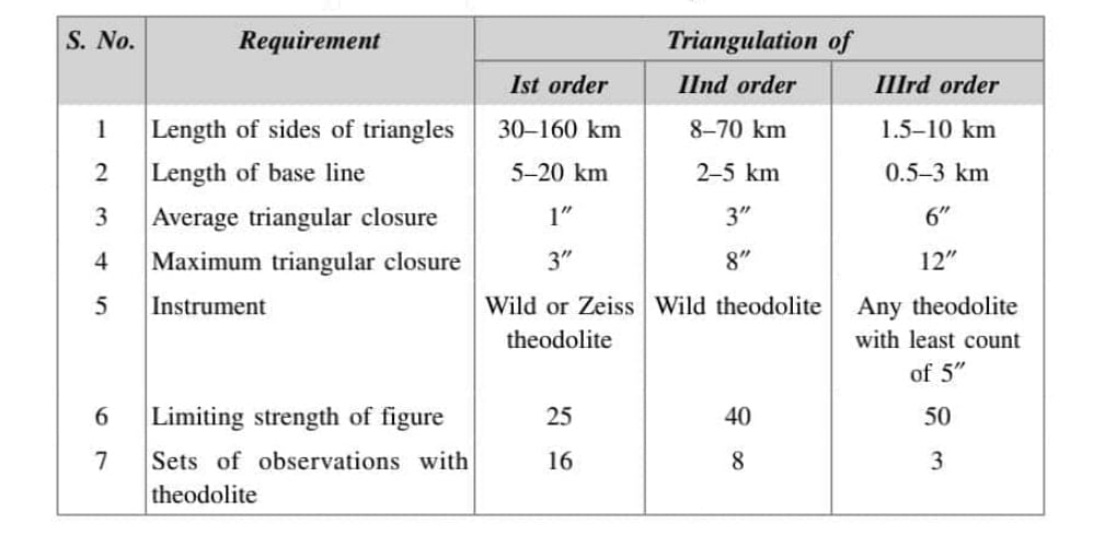
- Primary / 1st order Triangulation
- Secondary/ 2nd order Triangulation
- Tertiary/ 3rd order Triangulation
Primary / 1st order Triangulation
- A first order triangulation is the highest-order triangulation and is employed for very large areas, for example, for the earth’s figure, for obtaining the most precise control in mapping, and for small-scale mapping.
- It consists of forming large, well-conditioned triangles. Precise instruments are used for observations and every possible refinement is exercised.
Secondary/ 2nd order Triangulation
- A second-order triangulation is employed for running a second series of triangles by fixing points at close intervals inside the primary series of triangles.
- It consists of forming small, well-conditioned triangles with less precise instruments.
Tertiary/ 3rd order Triangulation
- A third-order triangulation is employed for running in a third series of triangles, by fixing points inside the secondary triangles at short intervals to furnish horizontal control for details on a topographic survey.
- The triangles are of the smallest size in comparison with the other two orders of triangulation.
Accuracy of Triangulation Networks
Objective Of Triangulation
- To establish accurate control for plain & geodetic survey of large area.
- To establish accurate control for photogrammetric survey of large area.
- To assist in determination of size & shape of earth by making observations of latitude & longitude.
- To determine accurate location of a points in engineering work such as location of a bridge over a large river location of a tunnel etc.
Triangulation Layout
In triangulation, arrangements of triangles can be kept as follow:
- Single Chain of Triangulation
- Double Chain of Triangulation
- Braced Quadrilaterals
- Centered Triangle & Polygon
Single Chain of Triangulation
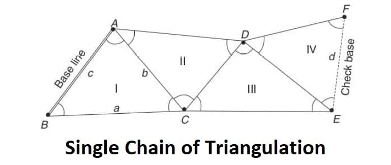
When a narrow strip of chain is to be surveyed then a chain of triangles is very economical and rapid. It is suitable to be used for making the boundaries of river, highway etc. It is simple, rapid and economical.
Double Chain of Triangulation
It is more accurate than previous one but in general its accuracy is also less.
Braced Quadrilaterals
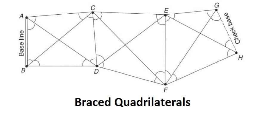
It is better system as compared to triangles due to availability of various combination of sides and angles that can used to compute the length of required sides and checks can be made frequently. Among all the quadrilaterals, the best quadrilateral is the square.
Centered Triangle & Polygon
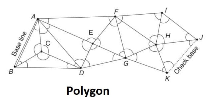
When a wide area is to be surveyed then a pentagon or a hexagon is more economical. However the pace of work reduce due to more number of settings of the instrument required. This system provides the desired checks on the calculations.
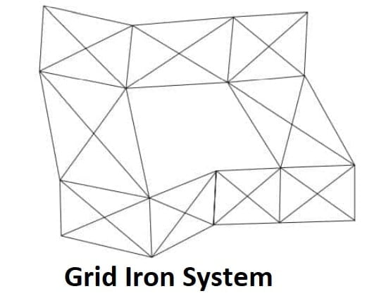
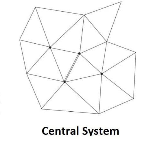
System Of Framework
The purpose of a system of framework is to establish a system of horizontal control points. By the use of these control points, different parts of the survey can be tied into the triangulation framework. For example, a traverse may begin and end at different control points.
Grid Iron System
Central System
Well Condition Triangle (***)
- For a well condition triangle any error in angular measurement should affect the calculated length as minimum as possible.
- Equilateral triangle is always perfected.
- In case of Isosceles triangle, the best shape considered with base angle of 56°14′ each.
- Triangle is called ‘well condition triangle”. If their angle not less than 30° & not more than 120°.
Trilateration
- Trilateration is a method of control survey in which a network a triangle is used as in triangulation.
- In this technique of triangulation, no angular measurement is measured. The three sides of the triangles are measured precisely using the electromagnetic distance measuring equipment. This technique is useful when angular measurement is difficult or impossible due to any reason.