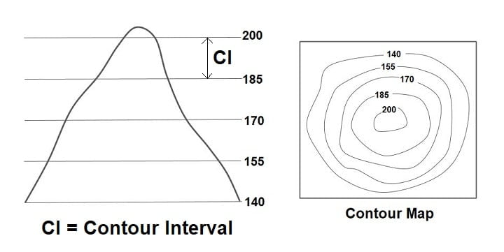
Contouring
A contour may be defined as an imaginary line passing through points of equal elevation on the earth surface. Or It may also be defined as the intersection of level surface with the ground of the earth. And the process of tracing contour line on the surface of the earth is called Contouring.
Note: If contours are drawn underwater they are termed as submarine contour/ Fathoms/ Bathymetric Curves.
Use of Contour
- Engineering works such as roads, canals, and other structures must be placed correctly and precisely.
- In deciding where to build new industrial plants.
- Identifying the intervisibility of stations.
- In planning and designing of construction like dams, reservoirs, aqueducts, transmission lines, etc.
- To calculate the amount of cutting, filling, and reservoir capacity.
Contour Interval
- Elevation difference between two consecutive contours is called the contour interval.
- It is desirable to have a constant contour interval, however in some special cases, a variable contour may also be provided.
- Generally contour intervals are taken 1 to 15m.
- Smaller contour interval is more precise for the analysis.
- The contour interval depends upon several factors as
- Scale of the map
- Purpose of the map
- Nature of the country
- Time
- Cost
Properties of Contour Lines
- All the points of a contour line have the same elevation.
- A contour line is a closed curve , however they may close either on the map itself or outside the map.
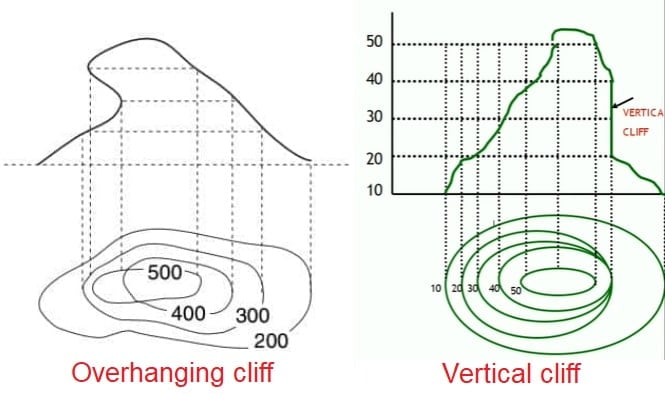
- Contour line do not merge or intersect each other except in the cases of an overhanging cliff or cave in the hillside.
- Contour lines never run into one another except in the case of a vertical cliff. In this case, several contours coincide and the horizontal equivalent become zero.
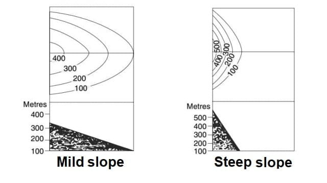
- If contours are parallel and equally spaced then it represents a uniform slope.
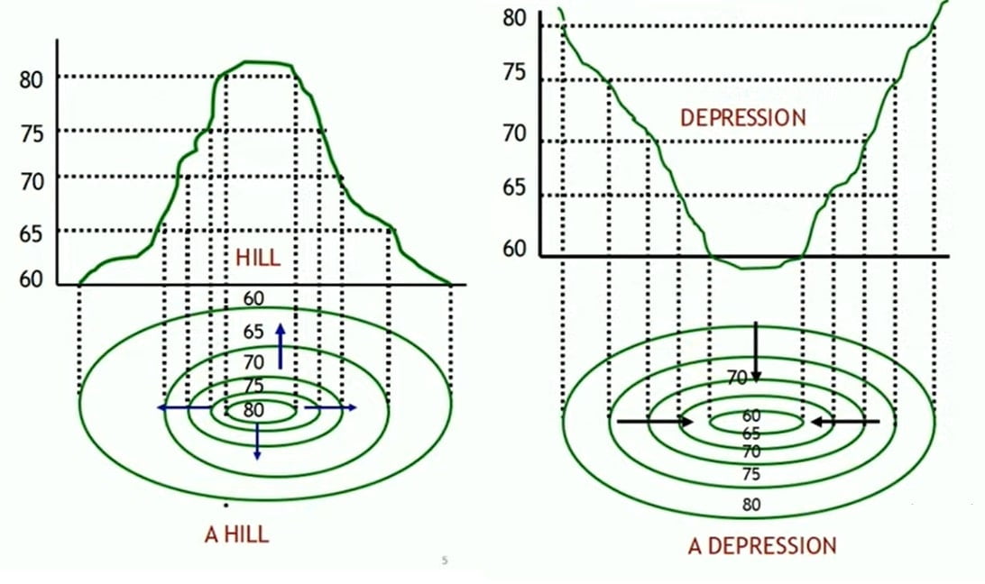
- A series of closed contour line on the map represent a hill, if the higher values are inside
- A series of closed contour line on the map represent depression, if the higher values are outside
- If the contours are closely spaced then it shows steep slope. But if contours are distant then it shows a relatively mild slope.
- Ridge line / Valley line intersects contour at right angle.
- Irregular contours represent rough terrain.
- Close contour loops represent either a hill or pond. For a hill reading increasing towards center, and for a pond reading decreasing towards center.
Ridge & Valley Line

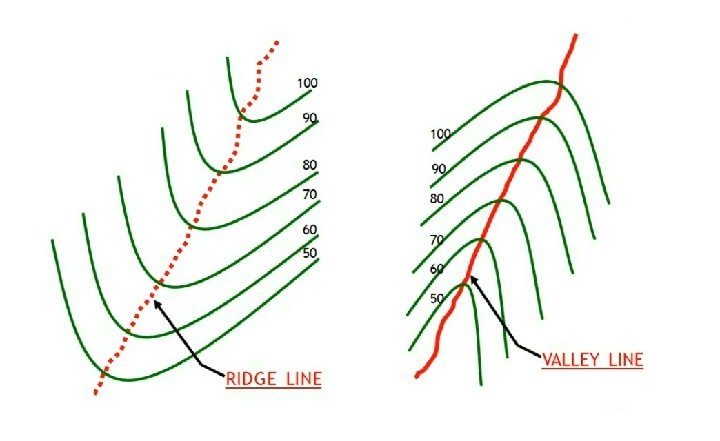
If the higher values are inside the loop in the contour it indicates a Ridge. Line joining the highest point of a hill across the contours at right angles is called Ridge line. It represent by U-shaped.
If the higher values are outside the loop in the contour it indicates a Valley. Line joining the lowest point of a valley across the contours at right is called Valley line. It represent by V–shaped.